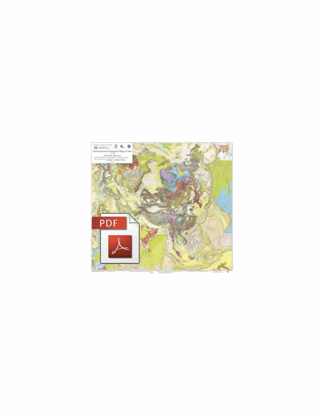


Carte géologique internationale de l’Asie-PDF
158,00 €
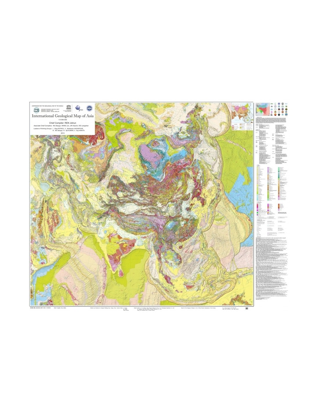
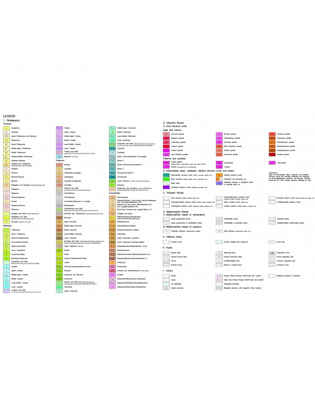
Scale: 1:5,000,000
Projection : Lambert Azimuthal Equal Area, Central Meridian E90°, lat. origin N40°
Main author: REN Jishun Co-authors: NIU Baogui, WANG Jun, JIN Xiaochi, XIE Liangzhen
Working group chiefs: I. Oleg PETROV, II. Abdolazim HAGHIPOUR, III. NIU Baogui, IV. Ajit KUMAR, V. K. WAKITA
Availability: In stock
Description
Carte géologique internationale de l’Asie-PDF
Scanned version in high resolution .pdf format, sent by download link.
Note This card is subject to a licence agreement.
Carte géologique internationale de l’Asie-PDF
This map is also available in digital .pdf format in our catalogue.
Carte géologique internationale de l’Asie-PDF
Carte géologique internationale de l’Asie-PDF (IGMA5000) est la première compilation à cette échelle réalisée à l’aide des techniques numériques. Elle montre la géologie des régions continentales et océaniques de l’entièreté du continent asiatique et ses régions avoisinantes, s’étendant depuis les Alpes à l’ouest jusqu’à la fosse des Mariannes dans son extrémité orientale, et depuis l’océan Arctique au nord jusqu’à la fosse de au Java au sud. Ce document fournit des informations essentielles à ceux qui souhaitent se familiariser avec la géologie de l’Asie depuis une perspective globale, à la fois qu’il constitue aussi un outil très utile pour la compréhension des rapports entre la tectonique du continent asiatique et celle des continents et océans qui l’entourent.
Carte géologique internationale de l’Asie-PDF
Some of the important advances taken into account in the compilation of the map are briefly summarised below.
1) A large number of Mesozoic volcanic formations found in the coastal zones of eastern Asia are now mainly attributed to the Cretaceous, instead of the Upper Jurassic-Lower Cretaceous. In Central Asia, most of the Permo-Carboniferous volcanic formations do not appear to be the result of arc volcanism, but of extensional dynamics. The lower Meso-Neoproterozoic limit of the Jixian section in China, previously dated at 1.8 Ga, has been rejuvenated to -1.68 Ga.
2) The most significant Neoarchean thermo-tectonic events in the Sino-Corean and Indian cratons occurred at 2.5 Ga rather than 2.7 Ga. The basement of the Yangtze craton formed at 0.75-0.8 Ga, i.e. 0.2-0.3 Ga after the Grenville orogenic cycle. Geologically, it has been determined that South China corresponds to a Lower Paleozoic Caledonian folded belt.
The Qinling belt, where no oceanic basin formed in the Triassic period, is not an Indosinian collision orogen, but is due to subduction of continental crust. At the time of the formation of Pangea, the Indo-Australian part of the supercontinent Gondwana was united with Paleo-Asia and consequently there was no ocean basin between these two blocks (no Paleo-Tethys from the Paleozoic to the Mesozoic). A large Indosinian orogenic belt existed in the southern margin of Palaeo-Asia, north of the present Zagros-Himalayas complex.
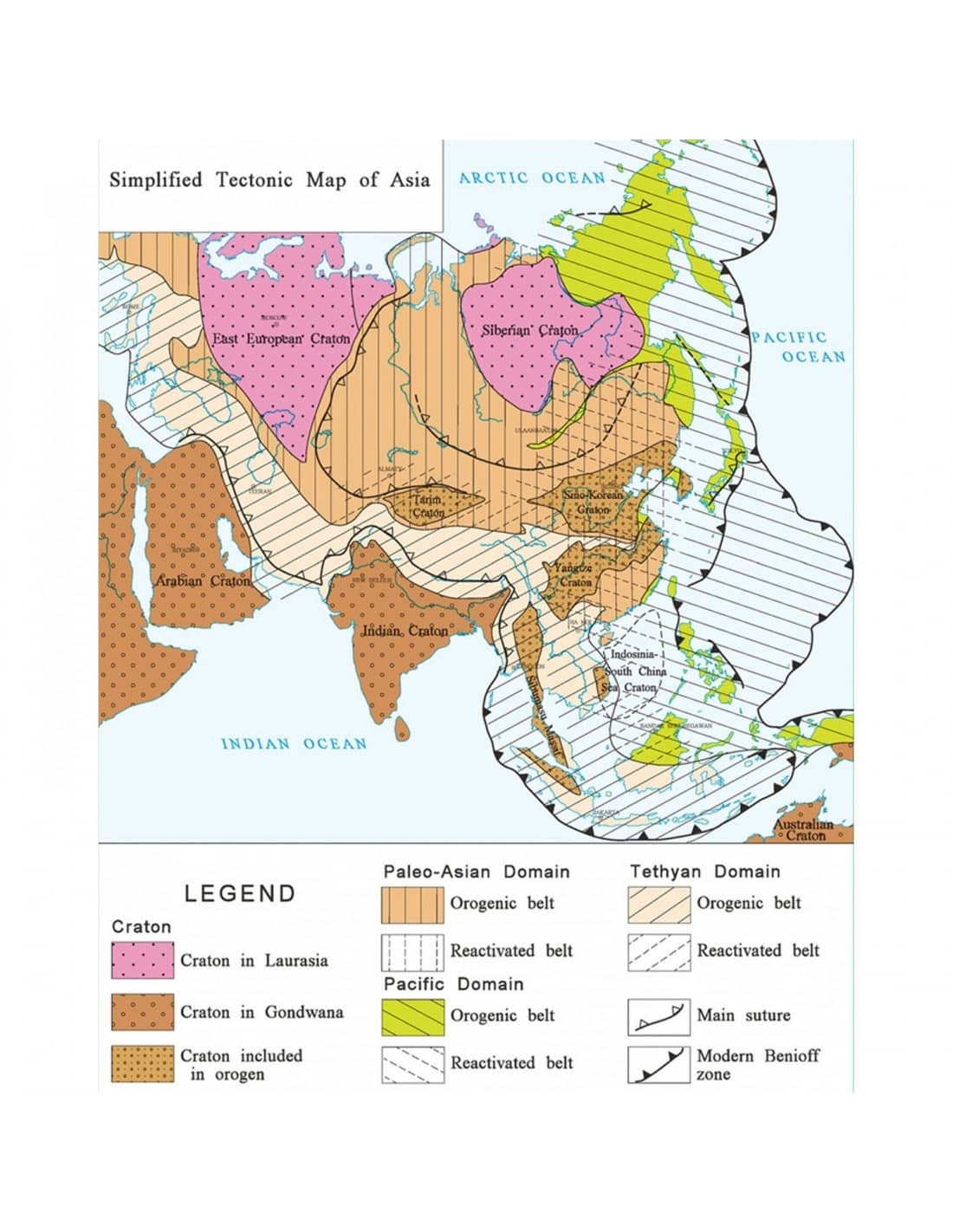
3) Asia is a composite continent consisting of three major cratons - Siberian, Indian and Arabian - and three major orogenic belts containing a number of minor cratons and micro-continents. Much of the Asian continent took its present form during the Mesozoic. The orogenic belts fall within three global tectonic domains: PalaeoAsia, Tethysian and Pacific.
On peut considérer que les cratons mineurs tels que le Sino-coréen, le Yangtze, le Tarim et le Sibumasu sont liés à une zone tectonique transformante entre le Gondwana et la Sibérie. Originalement situés dans la marge nord du Gondwana avant la disparition de l’océan paléo-asiatique, ces cratons, après la fermeture de l’océan paléo-asiatique, puis l’ouverture de la Tethys, se sont retrouvés sur la marge méridionale de la Paléo-Asie .
Le fait que l’âge des ophiolites en Asie diminue progressivement du nord au sud, tente à préciser qu’au cours du Phanérozoïque, la séparation du Gondwana et l’accrétion de l’Asie ont été accompagnées par la migration vers le sud des ceintures orogéniques de cette dernière.
It was Academician Ren Jishun, of the Institute of Geology of the Academy of Geological Sciences in Beijing, who proposed the creation of the International Geological Map of Asia (IGMA) at the General Assembly of the CGMW held in Paris in 2002. His proposal was endorsed by the CGMW Bureau and adopted by the General Assembly in Florence in 2004 at the 32nd International Geological Congress.
Carte géologique internationale de l’Asie-PDF
The work on the IGMA 5000 started in 2005 under the aegis of the CCMG and with the support of UNESCO. The Sub-Commission for South and East Asia of the CGMW, whose Chairman is Prof. REN Jishun, took the lead in its realization, with the collaboration of the Sub-Commissions of the CGMW for the Middle East, North Eurasia and Ocean Floor Maps, and the participation of geological institutions and services of the participating countries, namely: Cambodia, China, France, India, Indonesia, Iran, Iraq, Japan, Kazakhstan, Laos, Malaysia, Myanmar, Mongolia, North Korea, Pakistan, Philippines, Russia, Thailand, South Korea and Vietnam. The project has received technical and financial support from the Geological Survey of China, Sinopec Exploration and China National Petroleum Corporation.
Carte géologique internationale de l’Asie-PDF
Six working groups were set up to carry out this extensive mapping synthesis, which involved six international workshops held in Beijing between 2005 and 2012. The geographical distribution of the working groups and the institutions that made them up are as follows
- Group I Northern Eurasia. The CCMG Sub-Commission for Northern Eurasia and the All-Russia Geological Research Institute (VSEGEI) were responsible for the geological compilation of Russia, Central Asia and the oceanic areas of the countries concerned;
- Group II China, Mongolia and the Korean Peninsula. The CCMG Sub-Commission for South and East Asia, the Geological Survey of China, the Institute of Geosciences and Mineral Resources of South Korea (KIGAM) and the Institute of Geology and Mineral Resources of the Mongolian Academy of Sciences.
- Group II Middle East. The Middle East Sub-Commission of the CGMW was responsible for the compilation of the geological map of the Middle and Near East, the surrounding areas in Africa and the ocean regions.
- Group IV Japan and South-East Asia. The CCMG Sub-Commission for South and East Asia and the Geological Survey of Japan were responsible for the geological map of Japan, South-East Asia and the oceanic regions of the countries concerned.
- Group V South Asia. The CGMW Sub-Commission for South and East Asia and the Geological Survey of India were responsible for the geological map of South Asia and the surrounding oceanic regions.
- Group VI Drafting Committee which was responsible for synthesising all the data provided by the five working groups.
Carte géologique internationale de l’Asie-PDF


