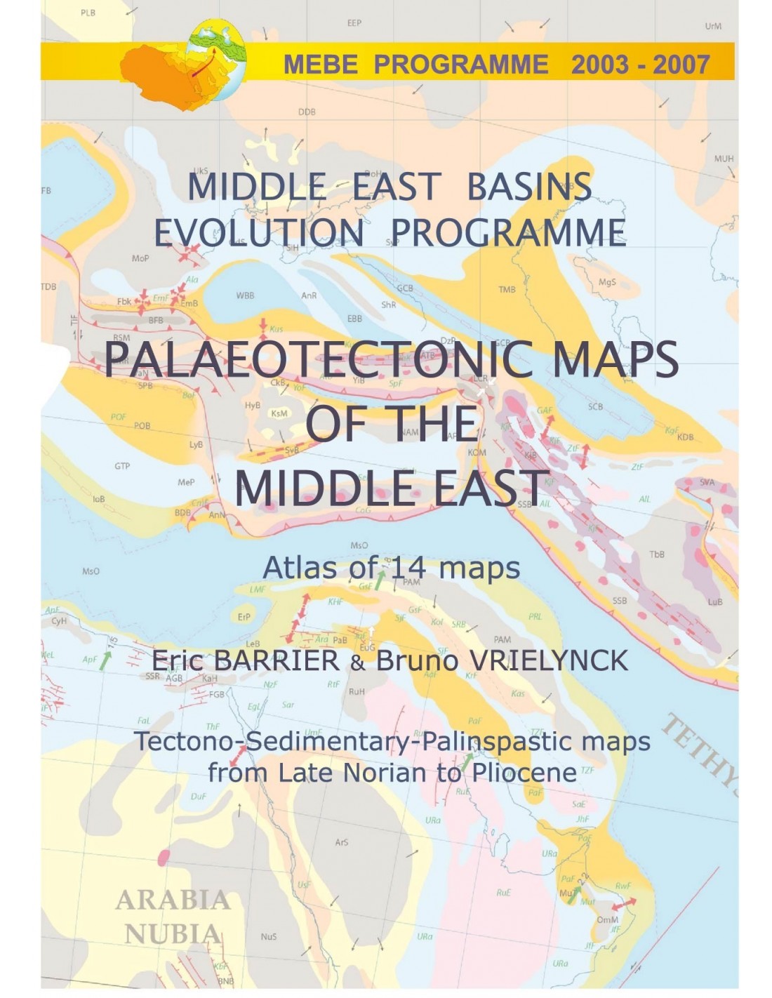


MEBE Atlas - Paleotectonic maps of the Middle East
32,00 €
MEBE Atlas
14 cards (54 x 48 cm)
Scale at the equator: 1:18,500,000
Mercator projection
L’ensemble de cartes est contenu dans un classeur en plastique transparent de format A4 (poids 0,575 Kg)
CCGM-CGMW © 2008
Authors: Eric Barrier and Bruno Vrielynck (CNRS-Université Pierre et Marie Curie)
Availability: In stock
Description
MEBE Atlas
MIDDLE EAST BASINS EVOLUTION PROGRAMME (MEBE)
RECONSTRUCTING THE EVOLUTION OF THE MIDDLE EAST SINCE THE MESOZOIC ERA
Le programme Atlas MEBE, d’une durée de 4 ans, a fédéré les efforts de grandes compagnies pétrolières (BP, ENI, PETRONAS, SHELL, TOTAL) et d’institutions françaises de recherche (INSU-CNRS, UPMC). MEBE a rassemblé un groupe de scientifiques dont l’expertise couvrait plusieurs domaines de la tectonique (analyse structurale, reconstitutions des paléostress, modélisation de la subsidence), de la stratigraphie (paléontologie, stratigraphie séquentielle, sédimentologie, analyse de la matière organique), de la pétrographie, de la cinématique et de la géophysique.
Il avait pour objectif la caractérisation des événements tectoniques majeurs et l’établissement d’une chronologie précise de l’évolution tectonique du Moyen-Orient depuis le Norien Supérieur jusqu’au Pliocène.
De 2003 à 2007, 26 projets scientifiques ont été financés dans 14 pays du Moyen-Orient, incluant la mer Noire, le Caucase, le nord de l’Iran, le Zagros, les marges arabes et le domaine du Levant. Chaque équipe de recherche associait des scientifiques européens et locaux. Environ 300 chercheurs de 28 pays représentant 100 universités et organisations de recherche se sont impliqués dans le programme Atlas MEBE.
Une conférence finale de 2 jours s’est tenue à Paris dans les locaux de l’UPCM en décembre 2007 et a réuni 150 participants. Un ensemble de 70 communications ayant trait à la géologie du Moyen-Orient, a rendu compte des résultats du programme.
The work of the MEBE-PDF Atlas has led to the following publications:
1) 4 special issues of GSL (Black Sea-Caucasus, South Caspian-Central Iran, Zagros, Levant margins)
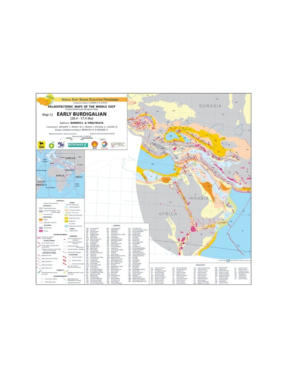
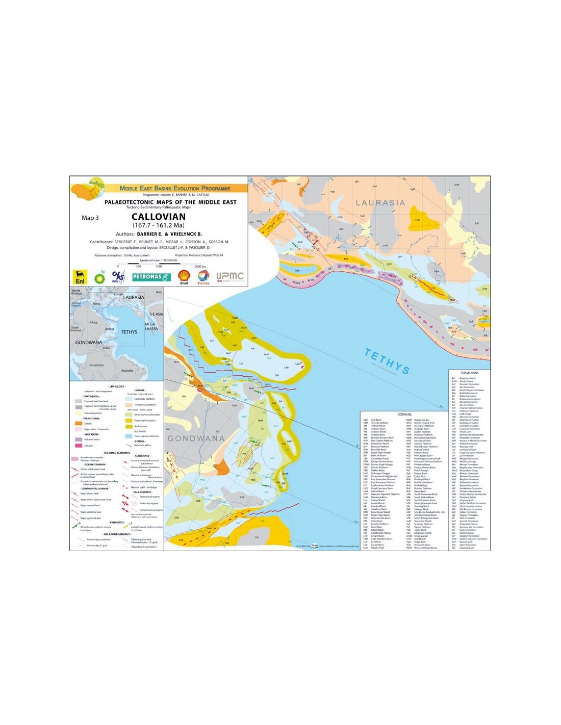
2) an atlas of 14 palaeotectonic maps showing the geodynamic and tectonic evolution of the Middle East since the Upper Triassic.
Notre reconstitution palinspastique démarre après la fin de l’orogénèse Eo-Cimmérienne du Trias supérieur. On distingue deux périodes majeures : pré-, et post-collision Arabie-Eurasie. Les cartes paléotectoniques sont basées sur une reconstitution cinématique actualisée des mouvements de l’Afrique-Arabie par rapport à l’Eurasie.
En 14 étapes, les cartes montrent : 1) les principaux éléments tectoniques incluant rifts, bassins de types variés, chaînes de montagnes principales et ceintures plissées, principales failles de décrochement, zones de subduction, prismes d’accrétion, etc.; 2) les principaux paléofaciès.
For the palinspastic reconstruction, we have adopted several hypotheses concerning the age and origin of the major tectonic events. For the pre-collision period, we assume that :
1) Up until the Arabian-Eurasian collision, the Neo-Thysian ocean was subducted at a northerly angle under the southern Eurasian margin for 170 Ma;
2) The eastern Mediterranean basin opened up in the Jurassic after rifting in the Triassic;
3) on the North Arabian margin, grabens opened up in the Senonian during obduction of the peri-Arabian ophiolites;
4) marginal and back-arc basins opened up on the Eurasian margin between the Jurassic and Middle Cretaceous (Black Sea basins, Great Caucasus basin, South Caspian basin, Central Iran basins) in connection with Neo-Thysian subduction;
5) short regional compressions leading to basin and margin inversions occurred in the Middle Jurassic, Upper Cretaceous and Terminal Cretaceous-Paleogene.
MEBE Atlas
As far as the collision period is concerned, we assume that :
1) The first compressional deformations linked to the Arabian-Eurasian collision occurred in the Upper Eocene;
2) this early stage of the collision involved only the Eurasian and Arabian margins and lasted until the Lower Miocene;
3) the continent-continent collision began in the Neogene, giving rise to the main orogenic belts in the Middle East (i.e. mainly the Caucasus-Alborz, southern Turkey and the Zagros ranges).
MEBE Atlas
Contributors :
F. Bergerat (CNRS-UPMC), M.-F. Brunet (CNRS-UPMC), J. Mosar (University of Fribourg, Switzerland), A. Poisson (Marcoussis, France) and M.Sosson (Géosciences Azur, France)
Design and model :
J.-F. Brouillet (CNRS-UPMC) and D. Pasquier (UPMC)
NOTE: The maps are published in English only.
MEBE Atlas
Informations complémentaires
| Weight | 0,575 kg |
|---|---|
| Packaging | |
| Length | |
| Width | |
| Thickness | |
| Weight | |
| Scale |


