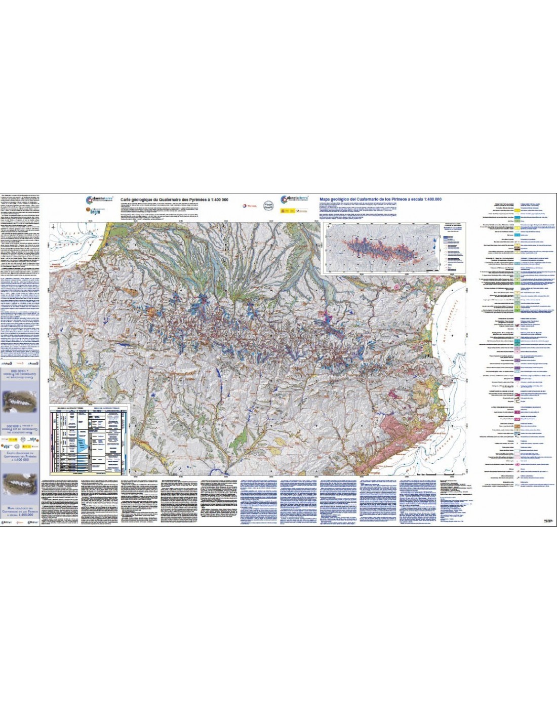
Geological map of the Quaternary of the Pyrenees
16,00 €
Geological map of the Quaternary of the Pyrenees
Scale: 1:400,000
Dimensions: 151 x 91.5 cm
Card available folded and flat
BRGM - IGME 2008
Map published together with the Geological Map of the Pyrenees at the same scale
Availability: In stock
Description
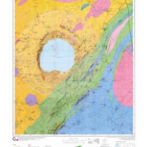
Geological map of the Quaternary of the Pyrenees
This map, whose topographic and road base is identical to that on the geological map of the Pyrenees, shows a number of units characteristic of the Quaternary period: post-glacial formations; terraces and fluvio-glacial formations; glacial formations (Würmian cycle and earlier glacial deposits); morphological features of the relief; volcanic apparatus; alterites of the granitic basement; karstic phenomena; prehistoric sites; wind phenomena; earthquakes.
The map is accompanied by two boxes: a diagram showing the extent of the Pyrenean glaciers during the Quaternary, and a table outlining the Pyrenean Quaternary.
This document is based on the summary map of the Quaternary of the Pyrenees drawn up in 1996 by Pierre Barrère (University of Bordeaux III) and updated by Marc Calvet (University of Perpignan), Serge Courbouleix, Inma Gil Peña and Santiago Martín Alfageme on the basis of unpublished maps (1:200,000 geomorphological and neotectonic map (IGME-ENRESA), 1:400,000 geomorphological and active processes map (IGME, cartografía MAGNA), and the doctoral thesis by B. Leránoz Istúriz].
The explanatory texts were written by Serge Courbouleix.
Informations complémentaires
| Weight | 0,165 kg |
|---|---|
| Packaging | Tube (e.g. rolled card), Envelope (e.g. folded card or booklet) |
| Length | |
| Width | |
| Weight | |
| Scale |