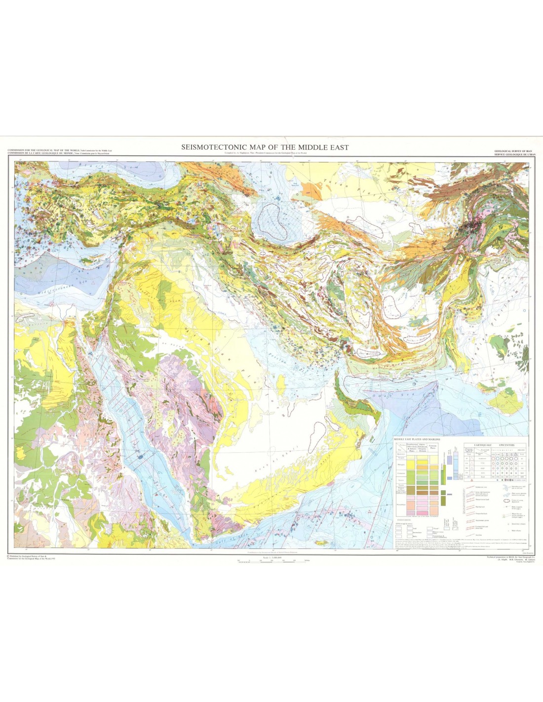
Seismotectonic map of the Middle East
10,50 €
Seismotectonic map of the Middle East
Scale 1:5 000 000
Published in 1992
Format: 96.5 cm x 76.5 cm
Co-publication CCMG - Geological Survey of Iran
Availability: In stock
Description
Seismotectonic map of the Middle East
Geo-teclotic base prepared using the geological map of the Middle East (compiled by A. Aghanabati, Geol. Sury. iran&CGMW, 1986); Seismotectonic map of Iran, Afghanistan and Pakistan (compiled by A. Hlighipour et. al., CGMW & UNESCO, 1984);
International Geological Map of Africa, sheets 2 and 3 (compiled by P. Choiubert et. al., CGMW & UNESCO, 1987, 1985).
Earthquake data change the NOAA, World Data Center A for Solid Earth Geophysics, National Oceanic and Atmospheric Administration, Boulder Colorado, USA; N.N. Ambraseys and C.P. Melville, 1982, A History of Persian Earthquakes, Cambridge Univ.
Press R.C. Quintmeyer and K.H. Jacob, 1978: Taurus. Seis Sar. Am, V. 69; P. Poirier and M.A.Taher, 1980: Bull. Séis. Soc. Am. v. 70.
Moho isopaches alter D.R. Soller, R.D. Ray and R.D. Brown, l982: Tectonics, no. JE; V.G. Trifonov et. al., 1986, Map of active faults in the USSR and adjacent areas: Moskow-lrkutsk.
Contours of gravity anomalies after C. Bowin, W. Warsi and .J. Milligan, 1981, World map of gravity anomalies in free air: Geol. Soé. d'Am., Inc.
Seismotectonic map of the Middle East
Informations complémentaires
| Weight | 0,095 kg |
|---|---|
| Length | |
| Width | |
| Weight | |
| Scale |