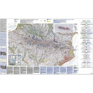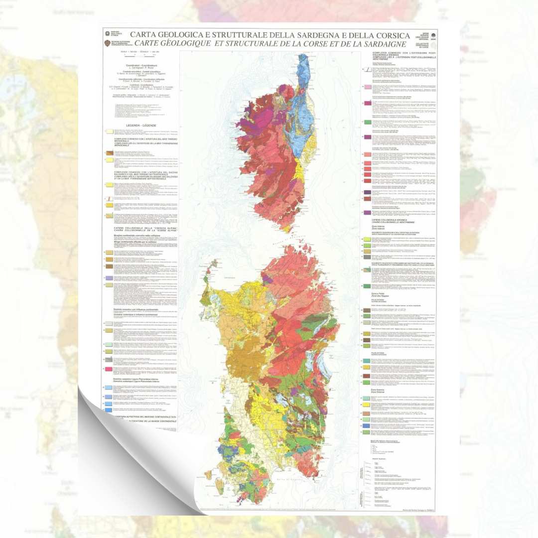
Geological map of Corsica and Sardinia
16,00 €
Geological map of Corsica and Sardinia
Scale: 1:500,000
Dimensions: 100 x 70 cm Coordinators: L. Carmignani, P. Rossi Editorial coordination: P. Conti, A. Eltrudis; A. Funedda, S. Pasci Bilingual Italian/French edition BRGM, Collectivité Territoriale de Corse
Dimensions: 100 x 70 cm Coordinators: L. Carmignani, P. Rossi Editorial coordination: P. Conti, A. Eltrudis; A. Funedda, S. Pasci Bilingual Italian/French edition BRGM, Collectivité Territoriale de Corse
Availability: In stock
Description
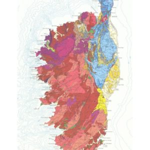
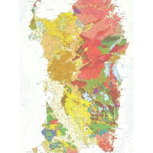
Geological map of Corsica and Sardinia
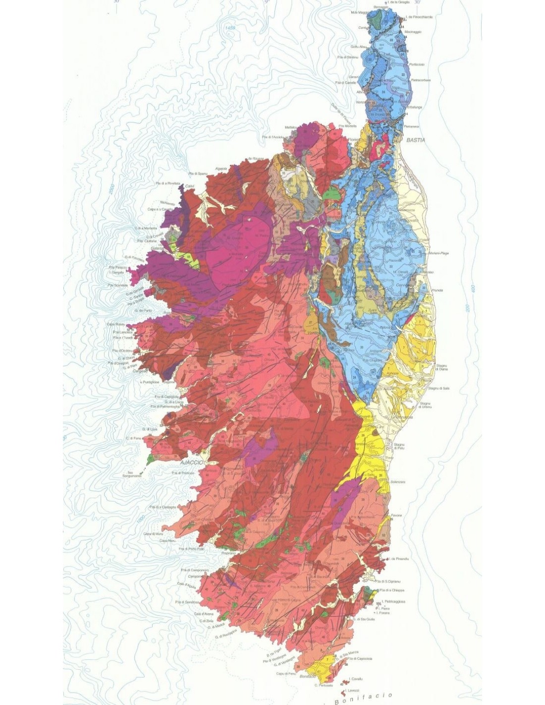
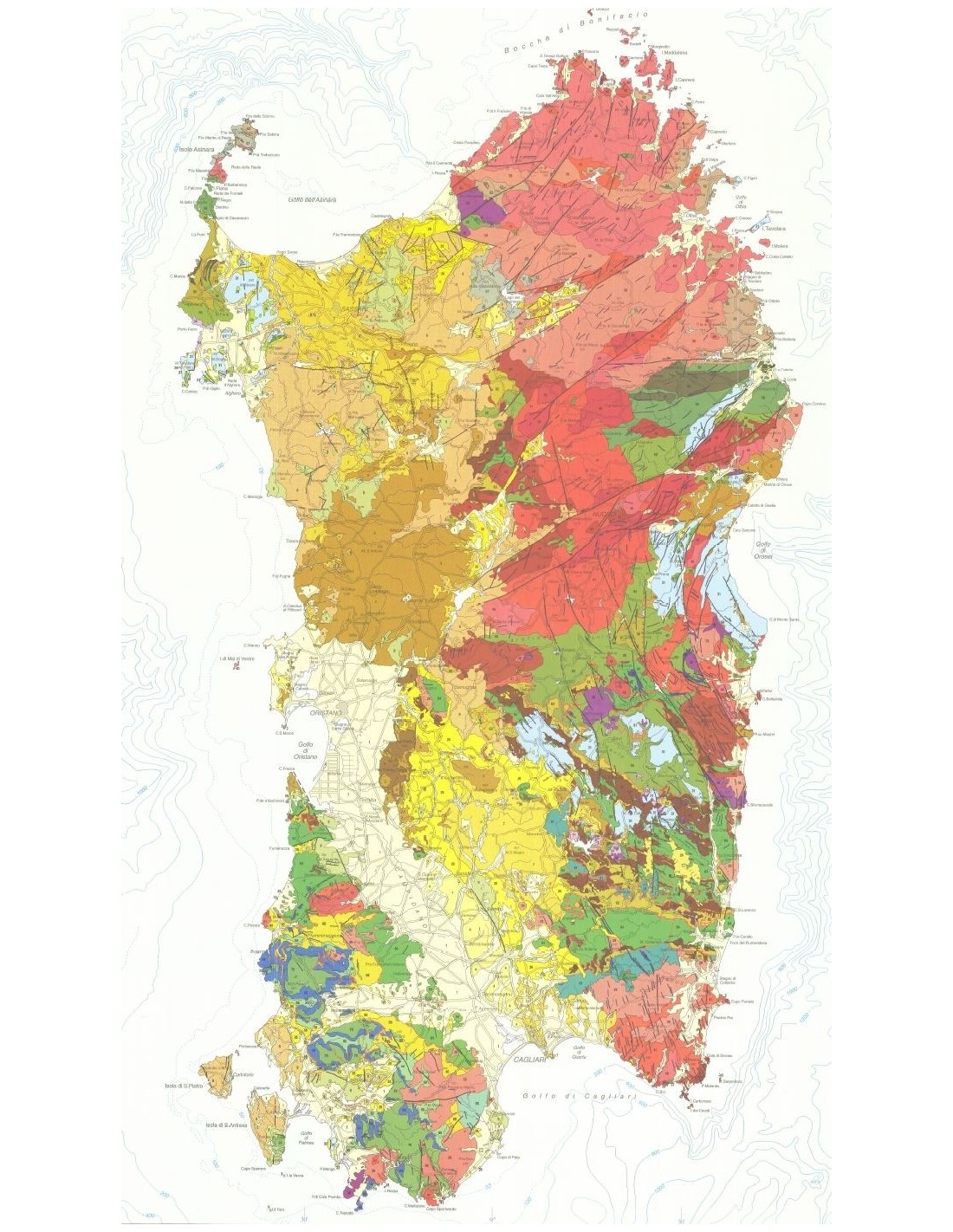
The originality of this Corso-Sardinian synthesis is to present the formations according to their chronology - as for the classic geological maps - but also according to the geodynamic context in which they were formed or are observed. Thus, the following have been distinguished:
1- for the Hercynian chain, the classic division into a) inner zone, b) nappes zone and c) outer zones and linking magmatism to the post-collisional extension of the chain;
2- the autochthonous cover of the South European continental margin;
3- the Balano-Ligurian and Ligurian-Piedmontese oceanic domain with continental influence;
4- the collisional chain of alpine Corsica, with in particular the eclogitic belt;
5- the complexes (in relation to the Apennines) linked to the opening of the Liguro-Provençal basin, the northern and then the southern Thyrrenian Sea.
Contributions: G. P. Cherchi, P. Conti, L. Disperati, A. Eltrudis, J. Ferrandini, A. Funeddan, J.-C. Lahondère, M.-D. Loÿe - Pilot, S. Pasci, E. Sarria, C. Spano
Informations complémentaires
| Weight | 0,2 kg |
|---|---|
| Packaging | Tube (e.g. rolled card), Envelope (e.g. folded card or booklet) |
| Length | |
| Width | |
| Weight | |
| Scale |